Kīlauea Iki Trail: Is It Worth It, How Hard It Is, and What Else to Walk Nearby
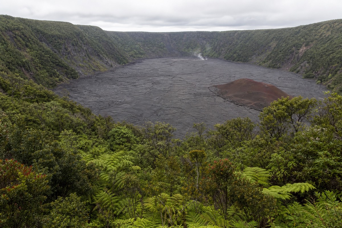
Most national park hikes look down at something. This one walks you out across the floor of a crater that was a churning lava lake within living memory, which is why it keeps turning up on lists of the best short hikes in the United States.
At a glance: the three walks compared
Distances and times as published by the National Park Service. The Chain of Craters figure is a drive, not a hike, and carries no food, water or fuel along its length.
Is the Kīlauea Iki Trail worth it?
Yes, and it is the single best use of two to three hours anywhere in Hawaii Volcanoes National Park. The loop drops 400 feet through rainforest and then crosses the floor of a crater that held a 400-foot-deep lava lake in 1959. Very few short hikes anywhere put you inside a landform this recent.
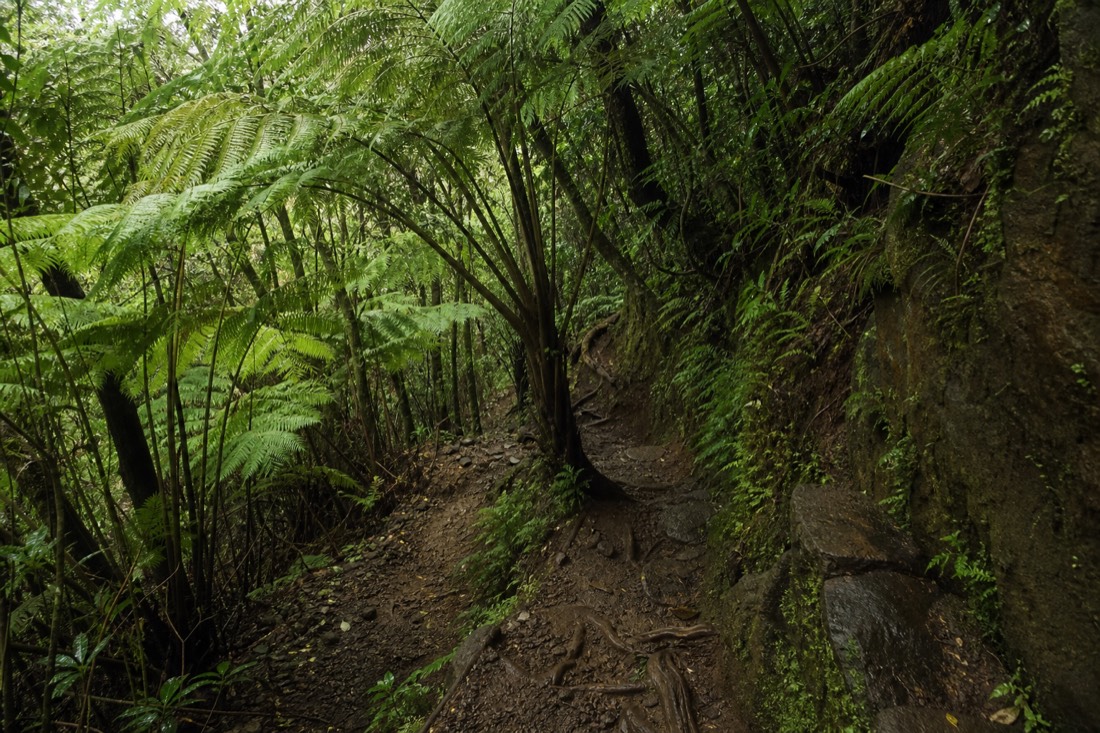
The reason it lands so hard is the contrast built into the route. You start on a rim so wet that hāpuʻu tree ferns arch over the path and moss coats the rock steps. Twenty minutes later you are standing on a flat grey plain with no shade, no soil and no sound except wind, looking up at the wall you just came down. It is the same crater in both cases.
It also happens to be one of the easier ways to understand what a volcano actually does, which is the argument for walking it rather than photographing it from the overlook. From above, the crater floor reads as a parking lot. From on it, you can see the pressure ridges, the cracked plates where the crust buckled as it cooled, and the cracks still leaking steam six decades later.
If you only get one walk in the park, make it this one. If you have a car and a whole day, the two other stops in this guide, Devastation Trail and Chain of Craters Road, turn it into a genuinely full itinerary without doubling back.
How long is the Kīlauea Iki Trail, and how long does it take?
From the Kīlauea Iki Overlook the trail is a 3.3-mile loop with a 400-foot descent and the same 400 feet of climb back out. The National Park Service tells visitors to plan on two to three hours, and that is an honest figure rather than a padded one.
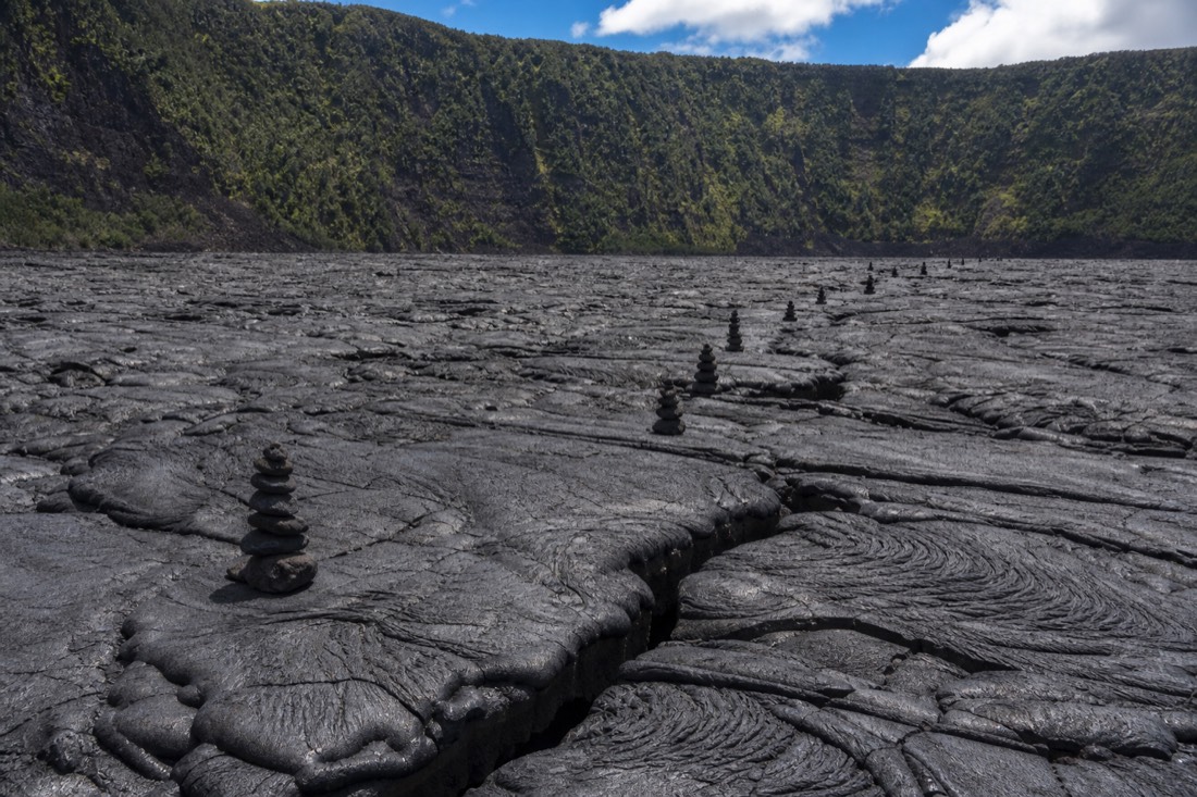
Three hours sounds generous for 3.3 miles until you walk it. The mile across the crater floor is slow going: the surface is uneven, you are stepping between cracks and following stacked stone cairns rather than a graded path, and almost everybody stops repeatedly because the scale keeps registering in stages. The climb out is where the time goes.
| Section | Roughly | What it is like |
|---|---|---|
| Rim forest to the descent | 25–35 min | Shaded, level to gently rolling, easy underfoot |
| The descent to the floor | 15–25 min | Switchbacks, rock steps, roots, often wet |
| Crossing the crater floor | 35–50 min | Flat but rough and fully exposed, no shade at all |
| Climbing back to the rim | 25–40 min | The hardest stretch, especially in the afternoon heat |
| Rim walk back to the car | 15–20 min | Shaded and flat, easy finish |
Add half an hour if you are photographing, and add more if you are travelling with children, who tend to move quickly on the floor and slowly on the climb. The published stats and current trailhead notes sit on the park's Kīlauea Iki page, which is the source to check the morning you go in case a section is closed.
How difficult is the Kīlauea Iki Trail really?
The Park Service rates it moderate to challenging, with steep and rocky terrain. In practice it is a straightforward walk for anyone comfortable on uneven ground with 400 feet of climbing, and a genuinely hard one for anyone with knee, ankle or heat problems.
Nothing about it requires scrambling or exposure. There is no drop-off you can fall from, no rope, no route-finding beyond following cairns. What it does have is a long stretch of loose rock underfoot and a climb at the end that arrives when you are already tired and hot.
The floor is the part that surprises people. It looks flat from the rim and it is flat in the sense that the elevation does not change, but the surface is a jumble of cracked and buckled plates, and putting a foot wrong on a crack edge is the most common way visitors turn an ankle here. Trainers are enough; sandals are not.
| If this describes you | Honest verdict |
|---|---|
| Regular walker, no joint issues | Comfortable. Bring water and go early. |
| Children aged roughly 7 and up | Usually fine, with an adult managing pace on the climb out |
| Knee or ankle trouble | The descent and the loose floor are the problem, not the distance. Poles help a lot. |
| Struggles in heat | Do it at 8am or not at all. There is no shade on the floor. |
| Uses a wheelchair or stroller | Not possible. Walk Devastation Trail instead, which is paved and accessible. |
| Respiratory or heart condition | Check the volcanic gas advisory first. Steam and gas concentrate in the crater. |
Should you hike it clockwise or counterclockwise?
Counterclockwise from the Kīlauea Iki Overlook is the more common choice, because it puts the steep descent early while you are fresh and spreads the climb back out over a longer, gentler grade. Clockwise front-loads the ascent instead. Both work; neither is dramatically harder.
The practical argument for counterclockwise is heat management rather than gradient. Going that way you cross the crater floor in the first half of the walk, which matters a great deal if you started at eight in the morning and matters enormously if you started at noon. The floor is the part of the route with no escape from the sun.
Clockwise has one genuine advantage: you get the overlook view of the whole crater at the end rather than the beginning, which some people prefer as a finish. If you are hiking with someone who tires on descents more than climbs, clockwise also gives them the gentler way down.
| Counterclockwise | Clockwise | |
|---|---|---|
| Steep section | Early, on the way down | Late, on the way up |
| Crater floor timing | First half, cooler air | Second half, hotter |
| Best for | Most people, especially in warm weather | Anyone who finds descents harder than climbs |
| Overlook view | At the start | Saved for the end |
Where do you park for the Kīlauea Iki Trail?
There are several ways on: the Kīlauea Iki Overlook lot, the Devastation Trail parking lot, the Puʻupuaʻi area and the Halemaʻumaʻu Trail. The overlook lot is the obvious first choice and also the first to fill. Park Service guidance is blunt about summit parking generally: lots can be full by 10am.
That single sentence is the most useful piece of logistics on this page. The overlook lot is small, the trail is popular, and there is no overflow to speak of. Arriving before nine solves the problem entirely; arriving at eleven on a cruise-ship day can mean circling.
Starting from the Devastation Trail lot is the standard fallback and has a hidden benefit: it lets you tack the paved Devastation walk onto the same outing without moving the car. Do not improvise a roadside space. The park is explicit that vehicles outside designated parking get towed.
| Trailhead | Fills up | Worth knowing |
|---|---|---|
| Kīlauea Iki Overlook | Earliest | Best first view of the crater, smallest lot |
| Devastation Trail lot | Later | Combines two walks from one parking space |
| Puʻupuaʻi | Varies | Another way onto the same loop |
| Halemaʻumaʻu Trail | Varies | Links the loop into the wider summit trail network |
What are you actually walking on down there?
A lava lake that formed between 14 November and 20 December 1959. Seventeen separate episodes of fountaining filled the crater with 440 feet of molten rock, and the fifteenth episode threw a fountain 1,900 feet into the air, the highest ever recorded at Kīlauea.
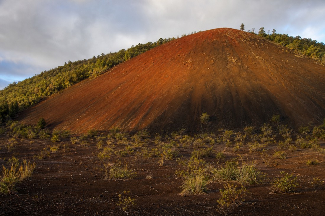
Those numbers come from the USGS record of the 1959 Kīlauea Iki eruption, and they explain most of what you see on the ground. The cinder that buried the forest on the downwind side came out of those fountains. The cone standing above the southwest rim, Puʻupuaʻi, is a pile of that same material. And the crust you walk on is the chilled top of the lake, which has been slowly cooling underneath ever since.
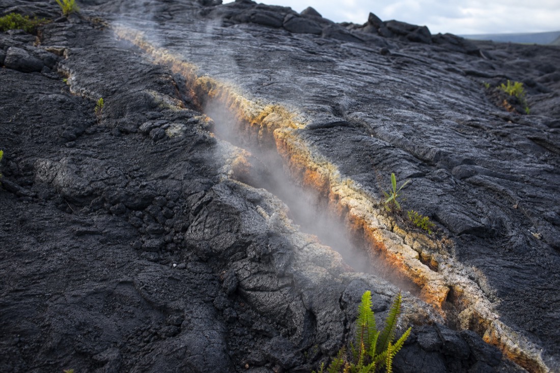
That cooling is not finished. Steam still rises from cracks in the floor on cool mornings, which is the moment the whole thing stops being an abstraction for most visitors. Ferns and small ʻōhiʻa seedlings have taken root in some of those cracks, colonising bare rock the way they have colonised every flow on this island for millions of years.
| 1959 eruption | Figure |
|---|---|
| Dates | 14 November to 20 December 1959 |
| Episodes of fountaining | 17 |
| Highest fountain (episode 15) | 1,900 ft (580 m), a Kīlauea record |
| Depth of lava filling the crater | 440 ft (135 m) |
| What is left today | A cooled crust you can walk across, still venting steam |
If the volcanic story is what draws you rather than the walking, our page on seeing Kīlauea without a tour covers the self-drive logistics for the rest of the summit, and the lava tube above Hilo in our Kaumana Caves guide shows the same processes from the inside.
Is the Devastation Trail worth adding?
Yes, and it costs almost nothing in time: one mile round trip on pavement, about an hour, wheelchair and stroller accessible. It crosses the cinder field the 1959 fountains buried, so it is the surface-level companion to the crater floor you just walked.
The Park Service notes that sections of the paved path exceed an 8 percent grade, so accessible does not mean effortless for a self-propelled wheelchair, but the surface itself is genuinely smooth throughout. Trailheads are the Puʻupuaʻi lot or the Devastation Trail lot, both on Crater Rim Drive.
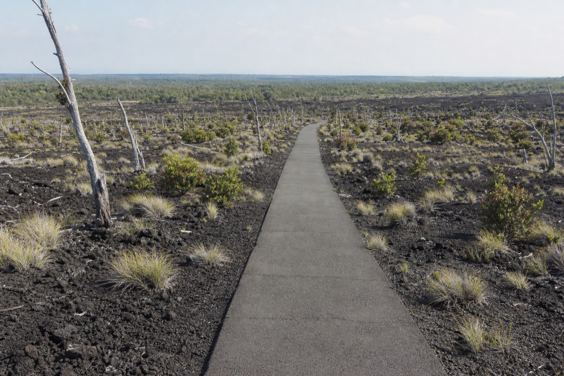
What you see is a recovering landscape rather than a dramatic one: bleached dead trunks still standing in black cinder, with ʻōhiʻa and grasses pushing back through. It is the best short illustration in the park of how quickly this island reclaims its own destruction. Nēnē, the endangered Hawaiian goose, are frequently around, and the park asks visitors not to feed them.
Two things not to do: do not climb Puʻupuaʻi, which is prohibited, and do not treat this as a substitute for the Kīlauea Iki loop if you are able to walk the loop. Details and current status are on the park's Devastation Trail page.
Is Chain of Craters Road worth the drive?
If you have the day for it, yes. It runs 18.7 miles one way from the Devastation Trailhead down to the coast, about 30 minutes each way without stopping, and it drops you from wet summit forest into a black lava desert above the sea. The catch is that there is no food, water or fuel anywhere along it.
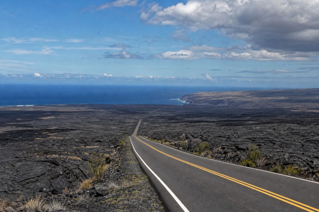
Treat it as a second, separate outing rather than an add-on. An hour of driving with no stops, plus the stops you will inevitably make, plus the walk to the sea arch at the bottom, is a solid three hours. Doing it after the Kīlauea Iki loop makes for a long but very satisfying day.
At the end of the road, the observation area for Hōlei Sea Arch sits about 1,000 feet past the gate on the right-hand side, and the whole walk out and back runs 20 to 30 minutes. The arch itself stands around 90 feet high. The Park Service warns that the cliffs may be unstable and asks people to stay inside the designated area, which is not boilerplate on a coastline built entirely of young, fractured lava.
| Practicality | Reality on Chain of Craters Road |
|---|---|
| Length | 18.7 miles one way from the Devastation Trailhead |
| Drive time | About 30 minutes each way with no stops |
| Food and water | None. Fill up in Volcano Village or Hilo. |
| Fuel | None anywhere in the park |
| Restrooms | Vault toilets at the Maunaulu parking area and at the end of the road |
| At the bottom | Hōlei Sea Arch, roughly 90 ft high, 20–30 min walk from the gate |
Full stop-by-stop notes are on the park's Chain of Craters Road tour page. The coastline it ends on is the same young shoreline that produces the island's black sand, a process laid out in our guide to black sand beaches on the Big Island.
What is the best trail to see Kīlauea?
For the crater itself, Kīlauea Iki. For the summit caldera and any eruptive glow, the rim overlooks rather than a trail. For a wheelchair or a very short visit, Devastation Trail. For the scale of the volcano as a whole, the drive down Chain of Craters Road beats any single walk.
The question gets asked as though one trail shows you everything, and none of them does. Kīlauea Iki is a crater within the larger Kīlauea caldera, not the caldera itself, and the two are genuinely different sights. Visitors who walk the loop and leave often have not actually looked at the main caldera at all.
| What you want to see | Where to go | Time |
|---|---|---|
| Inside a crater, on the floor | Kīlauea Iki Trail | 2–3 hours |
| The main caldera and Halemaʻumaʻu | Summit rim overlooks off Crater Rim Drive | 1–2 hours |
| Any eruptive glow | The named summit viewpoints, after dark | Evening, headlamp needed |
| Steam and sulphur ground activity | The steam vent area on the rim | 30 minutes |
| Accessible walking | Devastation Trail | About 1 hour |
| The volcano's full scale, coast to summit | Chain of Craters Road | Half a day |
Whichever you pick, check the park's current conditions page the morning you drive. A summit construction project running into late 2026 has closed the Kīlauea Visitor Center and parts of its parking, and individual overlooks open and close with volcanic activity. Our volcano tours guide compares the guided options if you would rather not make those calls yourself.
What should you wear and carry?
Closed shoes with grip, more water than feels necessary, rain gear, sun protection, and a layer for the rim. The summit sits around 4,000 feet, so it is cooler and far wetter than Hilo, and the crater floor is hotter and drier than either.
The park's own list for this hike is water, food, hat, sunscreen and rain gear, with a warning to expect hot, dry, wet and windy conditions in the same outing. That is not hedging. A single loop here can genuinely deliver drizzle on the rim and full glare on the floor within forty minutes.
| Item | Why it matters here |
|---|---|
| Closed shoes with grip | Wet rock steps on the descent, cracked plates on the floor |
| 2 litres of water per person | No water anywhere on the trail or on Chain of Craters Road |
| Rain shell | Rim forest is genuinely wet, often without warning |
| Warm layer | 4,000 ft and exposed wind on the rim |
| Hat and sunscreen | Zero shade for the full crossing of the floor |
| Snack | Nothing is sold inside the park beyond the entrance area |
| Trekking poles (optional) | Genuinely useful on the descent and on loose floor rock |
Cash is no use at the entrance station, which takes cards only. If you are working out where the volcano fits in a wider trip, our Hilo trip-planning guide and the best time to visit Hilo page cover the seasonal picture.
Who should skip the Kīlauea Iki loop?
Anyone with significant knee or balance problems, anyone on a tight cruise-ship clock, anyone visiting in the middle of a hot afternoon with no water, and anyone whose doctor has flagged a heart or lung condition that volcanic gas would aggravate.
The cruise case deserves its own note. From the Hilo pier you are looking at 45 minutes each way plus the entrance queue plus a three-hour hike, and that is before the walk to the parking lot. It is doable on a long port call and reckless on a short one. Our Hilo cruise day guide lays out what actually fits in a port day.
There is no shame in the overlook. Standing at the Kīlauea Iki Overlook for fifteen minutes gives you the crater, the cone, the forested rim and the sense of scale. It is the same view the hikers get before they start walking, and on a wet afternoon with the cloud sitting low, it is often the better one.
A worked plan for doing all three in one day
Leave Hilo by 7:15am, walk Kīlauea Iki first while the floor is cool, add Devastation Trail from the same parking area, then drive Chain of Craters Road in the afternoon and decide at dusk whether the webcams justify staying for dark.
This order exists for one reason: heat. Every version of this day that goes wrong involves someone crossing the crater floor at 1pm. Everything else on the list tolerates afternoon weather; the floor does not.
| Time | Stop | Note |
|---|---|---|
| 7:15am | Leave Hilo, Highway 11 | 30 miles, about 45 minutes |
| 8:00am | Entrance station, card payment | $30 per private vehicle |
| 8:15am | Kīlauea Iki Trail, counterclockwise | 2–3 hours, park before 9 to get a space |
| 11:15am | Devastation Trail | 1 mile, paved, about an hour |
| 12:15pm | Lunch you brought with you | Nothing is sold beyond the entrance area |
| 1:00pm | Chain of Craters Road down to the coast | 18.7 miles, stop often |
| 2:30pm | Hōlei Sea Arch viewing area | 20–30 minute walk from the gate |
| 4:00pm | Back up to the summit overlooks | Different light, different crowd |
| Dusk | Stay or drive home | Only stay if the webcams show something |
If that reads like a lot of driving to organise on holiday, it is. A guided Kilauea Iki and lava-tube hike covers the walking portion; it does not replace your transport to the park or the separate Chain of Craters drive. Choose a broader Hilo departure when transport and a park overview matter more than the full crater loop.