Waipiʻo Valley: Why It's Closed, and What You Can Still See
Every guidebook still describes riding a mule or a shuttle down into Waipiʻo Valley. Most of that is no longer true, and pretending otherwise sends people to a locked gate. Here is what's actually accessible right now.
Why is Waipiʻo Valley closed?
The county closed general public vehicle access to the valley floor in February 2022 after an engineering assessment found an elevated risk of rockfall on the access road. It was never a full closure of the valley itself, only of who is allowed to drive down into it.
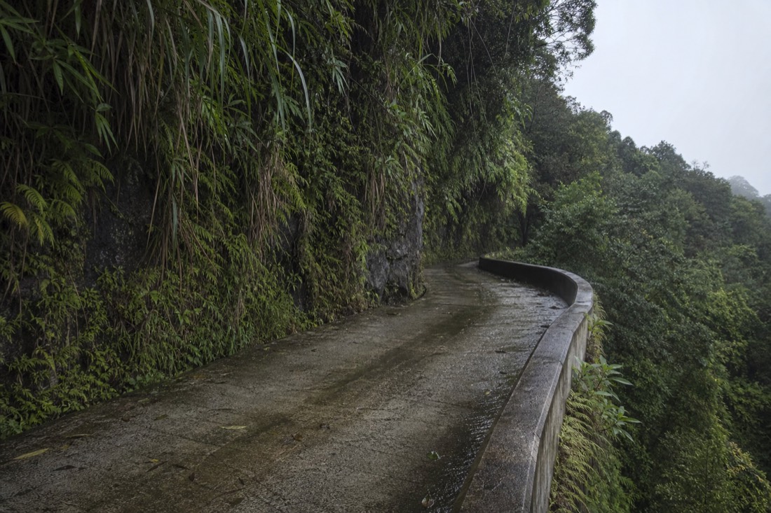
The road down into Waipiʻo has always had a reputation, it's one of the steepest public roads in the country, with sections cited around a 25 to 40 percent grade. After a geotechnical review flagged real safety concerns, the County of Hawaiʻi issued an emergency rule restricting who could legally drive it, and that rule has been renewed roughly every couple of months ever since rather than lifted. As of this writing it is still in force. The county's ongoing emergency-rule notices are published through its official county news page each time the rule is continued.
Can you still go into Waipiʻo Valley?
Only if you're a resident, a Native Hawaiian exercising traditional and customary rights, or a client of a licensed, permitted tour operator with county authorization. Walking down the road is not an exception; it is not permitted for general visitors either.
That last point catches people out. Before 2022, hiking down was the default free option for anyone who didn't want to pay for a shuttle or horseback tour. That workaround no longer exists under the current rule. The road itself is the restricted resource, whether you're behind a wheel or on foot.
| Who | Can they drive down? |
|---|---|
| Hawaiʻi County residents | Yes, under the current rule |
| Native Hawaiians exercising traditional/customary rights | Yes, under the current rule |
| Licensed, permitted commercial tour operators | Yes, with a permit from the Mayor's Office |
| General visitors, self-drive | No |
| General visitors, on foot | No, walking the road is also restricted |
Can you still hike into Waipiʻo Valley?
Not on the main access road, which is off-limits to visitor foot traffic under the current rule, the same as vehicle traffic. There is no separate, sanctioned hiking trail down into the valley that bypasses that restriction.
Anyone telling you there's a workaround footpath down is describing an outdated situation or an unauthorized one. Respect the restriction rather than testing it, both because it's a real safety rule following a genuine rockfall assessment and because the valley is home to roughly 100 residents farming taro on land some families have worked for generations. Unauthorized access is a real intrusion on a lived-in place, not a victimless shortcut.
Is the Ride the Rim ATV operator still running?
No. Ride the Rim, the operator that ran ATV tours along the valley's rim, has permanently closed. If you've seen it recommended in an older article or forum post, treat that as out of date.
This is a straightforward correction worth making plainly rather than leaving buried in a table: the tour is gone, not paused. Do not plan a Waipiʻo day around it.
What used to be available, and why doesn't it work anymore?
Before 2022, Waipiʻo was commonly visited by mule-drawn wagon, shuttle van, horseback and self-guided hiking, all of which used the same steep access road that is now restricted. Every one of those options depended on general public access to that road, so all of them stopped operating, or moved, when the rule changed.
It's worth spelling this out because so much travel content describing Waipiʻo predates the closure and simply hasn't been updated. A wagon tour or shuttle company that hasn't updated its own website is not a sign the restriction has lifted, it is usually a sign the business has quietly stopped operating or shifted to permitted status only, which very few managed to secure.
| Used to be available | Status now |
|---|---|
| Self-guided hike down the road | No longer permitted for general visitors |
| Mule-drawn wagon tours | Discontinued with the road restriction |
| Shuttle van tours to the valley floor | Only permitted, licensed operators with a county permit still run these |
| Horseback tours | Same restriction applies; confirm current permit status before booking any operator |
| Ride the Rim ATV tours | Permanently closed |
| The free lookout | Unaffected, still open and free |
What can you actually see at Waipiʻo?
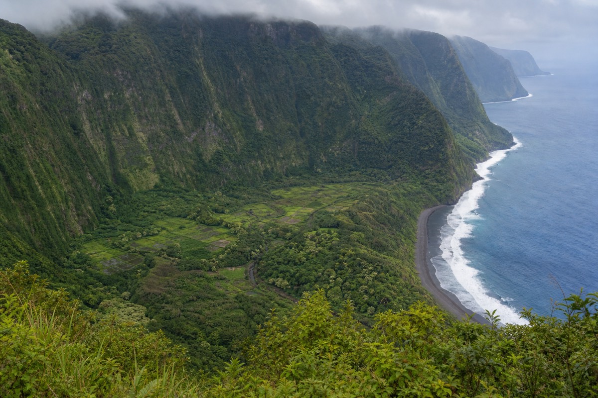
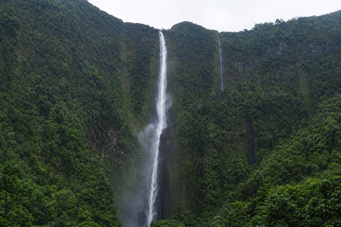
The lookout at the top of the road, and it is genuinely worth the drive on its own. It's free, requires no permit, and gives you the full amphitheater view most people picture when they think of this valley: the taro terraces, the black sand beach at the river mouth, and Hiʻilawe Falls dropping down the back wall.
This is the honest reframe for anyone planning a Waipiʻo day right now: the lookout isn't a consolation prize, it's what most visitors actually experience, restricted road or not. A short paved path leads from the parking area to a platform with interpretive panels, and the view from there covers the whole valley floor at once, something you don't get from inside the valley itself.
| At the lookout | Detail |
|---|---|
| Cost | Free |
| Access | Short paved path from the parking area, no permit needed |
| What you see | The full valley floor, taro terraces, black sand beach, Hiʻilawe Falls |
| Hiʻilawe Falls | About 1,450 feet, among the tallest waterfalls in Hawaiʻi |
| Facilities | Restrooms and parking at the lookout; nothing below |
Why does this one valley get so much attention?
Waipiʻo carries real historical weight beyond its scenery. Hawaiian tradition holds it as the birthplace and childhood home of Kamehameha I, and it was once a seat of Hawaiian royalty. Today it remains an actively farmed, lived-in place, home to roughly 100 residents growing taro (kalo) on terraced loʻi some families have worked for generations.
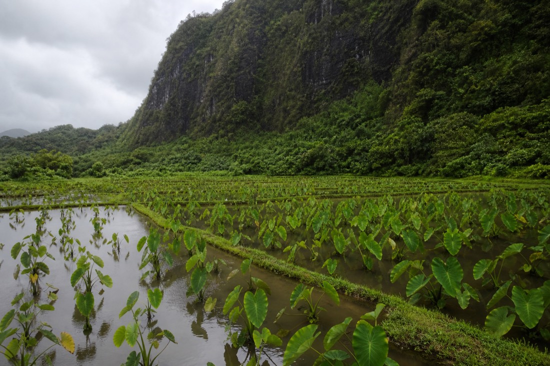
That's the part easy to miss from the lookout: this isn't a preserved museum valley, it's someone's working farmland and home. The taro terraces you can see from above are in active production, feeding both the valley's own residents and Hawaiʻi's wider poi supply chain. The current access restriction, whatever its safety justification, also has the effect of protecting that daily life from the volume of visitor traffic a fully open road would bring.
| Waipiʻo at a glance | Detail |
|---|---|
| Cultural significance | Traditional birthplace of Kamehameha I, former seat of Hawaiian royalty |
| Residents today | Roughly 100, farming taro on family-worked loʻi |
| Valley depth | About 2,000 feet from rim to floor at its deepest |
| Hiʻilawe Falls | Roughly 1,450 feet, visible from the lookout on clear days |
| Beach at the river mouth | Black sand, part of the same volcanic coastline covered in our black sand beaches guide |
Where is Waipiʻo Valley, and how do you get to the lookout?
The lookout sits at the end of Highway 240, past the small town of Kukuihaele, roughly 50 miles and about an hour and a half from Hilo. The drive there, through the Hamakua Coast's sugar country and gulches, is a genuinely scenic part of the day on its own.
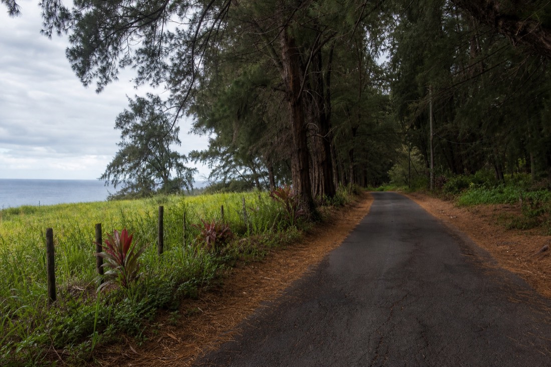
Kukuihaele itself is little more than a crossroads, but it's the last stop for gas, snacks or a bathroom before the road ends at the lookout. Parking fills up on busy days, so arriving earlier in the day tends to mean an easier time finding a spot and softer light for photos.
| From | Distance | Drive time |
|---|---|---|
| Hilo | ~50 miles | ~1.5 hours |
| Honokaʻa | ~9 miles | ~15 minutes |
| Waimea | ~17 miles | ~30 minutes |
Morning tends to bring the clearest air and the best odds of a rainbow catching in the mist off Hiʻilawe Falls, while afternoon cloud regularly rolls in and can obscure the far wall of the valley entirely. If photography is the goal, treat morning as the priority window rather than an afterthought.
Cell service is inconsistent along this stretch of the Hamakua Coast, so download offline maps before you leave Hilo rather than counting on data the whole way. Fuel up in Honokaʻa if you're running low, it's the last real town before the drive narrows toward Kukuihaele, and there's nothing resembling a gas station past that point.
Why was the road considered dangerous in the first place?
The road drops roughly 900 feet over a very short distance, putting sustained sections at a grade steep enough that it has always demanded low gear, good brakes and genuine driver attention, long before the 2022 restriction. What changed in 2022 wasn't the road's inherent steepness, it was a formal engineering finding that the surrounding slope carried an elevated rockfall risk.
Even in the years before the closure, the road was never treated casually. It called for a genuine 4WD vehicle in low gear, not a standard rental sedan, and locals who drove it regularly still approached it with more caution than an ordinary steep driveway. The 2022 assessment formalized a risk that had effectively been managed informally for years, rather than identifying something entirely new.
That context matters for understanding why the rule keeps getting renewed rather than made permanent or lifted outright. A geotechnical hazard like this doesn't resolve on its own, and any long-term fix, if one comes, would likely mean actual road engineering work rather than a simple decision to reopen access. Until that happens, expect the rolling emergency-rule structure to remain the status quo.
Is Waipiʻo similar to any other valley on the island?
Waipiʻo is the largest and most visited of several similarly carved valleys along the same Hamakua and Kohala coastline, cut by the same pattern of ancient streams eroding through the volcano's flank over a very long timescale. The others, deeper into the Kohala district, are even less accessible and see a fraction of the visitors.
What sets Waipiʻo apart isn't its geology so much as its history and continued habitation. It's the one of these valleys with a real, living community still farming its floor today, and the one with the cultural weight of being tied to Kamehameha I. The others are dramatic to look at from a distance but don't carry the same layered human story.
That combination, dramatic geology plus continued cultural and agricultural life, is also exactly why the current access restriction matters more here than it might elsewhere. A rockfall assessment closing a scenic road is one kind of story. A rockfall assessment closing the main access to a community's homes and farmland is a different, more consequential one, and it's worth holding both facts at once rather than treating the closure as purely a visitor inconvenience.
None of that history is visible standing at the lookout, but knowing it changes what you're actually looking at. It isn't an empty scenic backdrop, it's an active, working community's valley, seen from a respectful distance rather than up close, which under the current rules is exactly how most visitors are meant to experience it.
Compare that to the more developed waterfalls closer to Hilo, and the difference in character becomes obvious fast. 'Akaka Falls and Rainbow Falls are built for a steady stream of visitors, paved paths, viewing platforms, a parking fee. Waipiʻo was never built that way, and the current restriction, whatever its origin, has pushed it further in that direction rather than toward more development. For travelers who want the whole island to feel like a park, that can read as a letdown. For anyone who values a place that still functions primarily as somewhere people live and farm rather than a stop on a route, it's arguably the more honest version of what a Hawaiian valley actually is.
What should you know before you go?
Do not attempt to drive or walk down the restricted road, do not expect a mule ride or shuttle that older articles describe, and check current conditions before you go since the county's emergency rule is renewed on a rolling basis rather than fixed indefinitely.
Plenty of outdated content still online describes Waipiʻo the way it worked before 2022. Treat anything promising an easy self-guided descent, a still-operating mule ride, or Ride the Rim as wrong until you've confirmed it against the county's current notices.
What can you see from the lookout versus what you're missing?
The lookout gives you the full valley in one wide view: the amphitheater walls, the taro terraces as a green patchwork, the black sand beach and river mouth, and Hiʻilawe Falls on a clear day. What it doesn't give you is anything at ground level, walking among the taro, standing on the beach, or the closer view of the falls that a valley-floor visit provides.
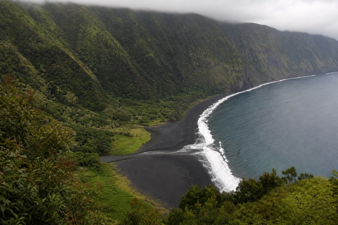
For most visitors, that tradeoff is a reasonable one rather than a real loss. The lookout view is genuinely the more photogenic angle for the valley as a whole, since it captures the scale that gets lost once you're standing inside it. What the valley floor adds is intimacy and detail rather than a fundamentally different view.
| From the lookout | Only from the valley floor |
|---|---|
| The full amphitheater view | Walking among the working taro terraces |
| The black sand beach, seen from above | Standing on the beach itself |
| Hiʻilawe Falls, distant but visible on clear days | A close-up view of the falls |
| Free, unlimited time | Requires resident status, cultural rights, or a permitted operator |
What's the honest way to fit Waipiʻo into a Big Island trip?
Treat the lookout as a standalone half-day add-on from the Hamakua Coast side of the island, not something current guided Hilo day tours include. No product on this site takes visitors into the valley floor, and we would rather say that plainly than imply otherwise.
What we can genuinely get you to is the rest of this side of the island in real depth. The Akaka Falls, volcanoes and Hilo full-day discovery tour covers the Hamakua Coast's other waterfalls and the volcano in one guided day, and the private east side custom tour can be built around whatever stops matter most to your group, with the flexibility to add the Waipiʻo lookout as one of them if the timing works. Neither goes into the valley floor, and we're not going to pretend they do. Our waterfalls near Hilo guide covers Hiʻilawe alongside the falls that are more directly accessible on foot.